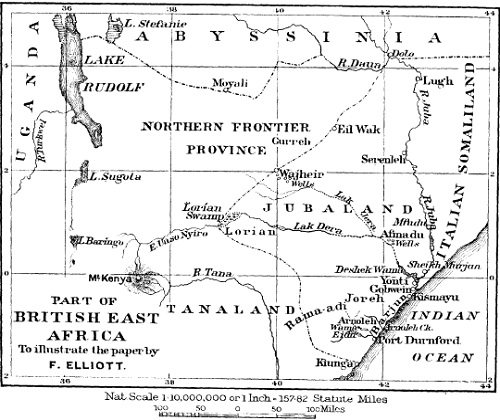
The Juba river district reaches from the junction of the Juba and the Daua rivers to Yonti. The right bank is under British rule; the left is in Italian territory. From the village of Dolo, where the Daua and Juba unite, as far down the river as Serenleh (a British military post), the district is wild and uncultivated. From Serenleh to Mfudu the bank immediate to the river is covered by a dense forest. The timber, however, is not of a valuable kind, though here and there rubber-vine may be found. From Mfudu to Yonti the bank is under cultivation by the Wa-Gosha tribes. The productions are maize and simsim. In this neighbourhood the Government have established an experimental farm. The Juba river district, with its richly fertile soil, should have a great future as a cotton-growing country.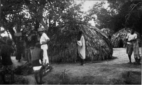
The Wa-Gosha are a confederacy of several tribes bound together for mutual protection against the Somali. The most important of the tribes are Wa-Zugoa, Yao, Wa-Swaheli, Wa-Gendu, and Mushunguli. All these tribes consist of fugitive slaves from the Somali, and they have taken refuge from their masters in the thick bush on the river-bank. Here at first they lived among the Boni tribe, to whom they gave presents as a kind of tribute. When the Wa-Gosha became more in number this tribute was refused and a fight ensued, in which the Boni were beaten and their chief killed. The Wa-Gosha then settled down, in spite of constant warfare with the Somali. This district under English supervision has an increasing population of agricultural people. They are Mohammedans. They do not attempt to keep any stock except a few goats; this is owing to the large number of tsetse fly in the bush around the swamps which are formed when the river rises in flood.
The district of Afmadu, sometimes called Bhoji, lies to the north-west of Kismayu at a distance of about 100 miles. It is a plain having thickets of bush separating grassy park-like spaces. The only permanent water-supply is at the Somali settlement of Afmadu, where there are 114 wells, many of which are now disused. The wells are in the dry river-bed of the Lak Dera, but by whom they were constructed cannot be determined. Certainly they were not made by the Somali who now use them. The heavy rains flood the country during October and November, leaving numerous small swamps, and thus a greater part of the district, where it is not covered with bush, is able to support vast herds of cattle even during the two dry seasons. This tract of country is the head-quarters of the powerful Ogaden Somali, many of whose chieftains are wealthy in cattle and camels. Ox-skins are the principal trade, and are sent to Kismayu for shipment.
The district of Eil Wak and of Wajheir have been lately described by Lieut. Aylmer. They lie on the northern boundary of Jubaland. Eil Wak (Demon Well or Well of Wak) is occupied by the Tufi Borana. Wajheir has numerous wells, and is peopled by a mixture of Borana, Gurreh [Garre], and Somali. Caravans of camels from Kismayu pass through these districts on their way to the Abyssinian border. It is from these caravans, returning from Abyssinia, that the Somali obtain modern rifles and ammunition. As in the Afmadu district, so in the Wajheir district, there are iminense herds of cattle.